| 1.1 MB | |
| 2008-04-21 14:12:46 | |
 | |
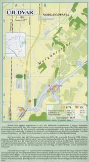
Nyilvános 2277 | 5892 | ÚJUDVAR | Újudvar neve egyben magyarázatot is ad a falu keletkezési körülményeire. A magyar helységnév /1193:Ojvduor/ annyit jelent, hogy ezen a helyen valaki új udvar-t, azaz udvarházat alapított. Ma 1038 a településen élő emberek lélekszáma. Az 1930-as évekig a lakosság mezőgazdaságból, szőlő- és bortermelésből élt, míg az utóbbi időben a fő megélhetési forrássá az ipar lépett elő, hiszen Újudvaron olaj- és gáztározók épültek. Turisztikai szempontból érdekes a falu fölötti dombtetőn található TV-torony, valamint a közeli sí-és szánkópálya. Sein Name erklärt auch die Entstehungsumstände des Dorfes. Der ungarische Ortsname (1193: Ojvduor) bedeutet, daß jemand an dieser Stelle új udvar-t, also einen Hofhaus gegründet hat. Die heutige Einwohnerzahl ist 1.038. Bis etwa 1930 lebte die Einwohnerschaft aus der Landwirtschaft und aus dem Weinbau, neulich wurde die wichtigste Einkommensquelle die Industrie, in Újudvar baute man ja Öl- und Gasspeicherräume. Aus touristischer Ansicht sind der Fernsehturm, der auf dem Hügel über dem Dorf liegt, der nähere Skiplatz und die Schlittenbahn interessant. The name of Újudvar gives an explanation for the establishing circumstances of the village. The place-name of Hungarian origin (in 1193 is Ojvduor) means that somebody established an új udvar(manor-house). The today\'s population of the village is 1038. Till the 1930s the population lived from the agriculture, wine-growing and viniculture but recently the industry has become the main source of living as there were oil- and gas-storage tanks building in Újudvar. From the touristical view of point thre are interesting the TV-Tower over the village and near ski-and sleigh-track. A részlet a következő kiadványból származik/Die Teile stammen vom volgenden Buch/This text came from the following book: Cím/Titel/Title: Zala megye településeinek atlasza - 257 település részletes térképe/Atlas der Komitat Zala - 257 Detailte Siedlungskarten/Zala county\'s Atlas - 257 settlement maps. Közreműködő/contributor: Lackner László (1943) (fotó) Kiadás/Ausgabe/Publisher: Gyula : HISZI-MAP, 1997 Sorozat/Serie/Series: Indulástól - megérkezésig... ETO: 912(439.121-2) ; 908.439.121 Cutter: Z 19 ISBN: 963-610-025-4 Oldalszám/Seiten/Pages: 323, 81 p. Megjegyzés/Note: Lezárva/Abgeschlossen am/Closed am: 1997. máj. 30. |
